After a hot day in the sun, there’s nothing more refreshing than a float down Turkey Creek.
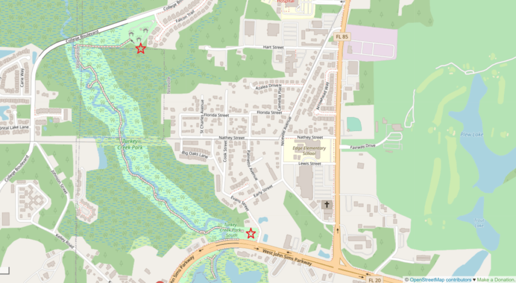
Just across Destin’s Midbay Bridge on the mainland is Niceville, Florida. If you turn left on Highway 20, heading through town towards the Destin Fort Walton Airport. you’ll soon come to Turkey Creek Nature Trail. Here’s a map showing where it’s located:
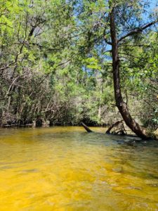
Turkey Creek Nature Trail is a park with a boardwalk extending through the wetlands adjacent to a cold water creek which has been created from rainwater runoff from northerly neighboring forests.
With put-in spots in Niceville and up in Crestview, Turkey Creek is a favorite spot for kayakers, paddle boarders and swimmers. (No fuel-powered vehicles permitted.) If you’re wanting to start off of State Road 85 before Crestview, you’ll need to get a recreational permit because this portion of Turkey Creek is located on Eglin Air Force Base Reservation. Permits can be requested through Jackson National Guard. The creek itself runs for about 9 miles as a completely natural stream and then passes the boardwalk in Niceville before it empties into Boggy Bayou.
The nature trail consists of a boardwalk that winds through the woods for about a mile between John Sims Parkway and College Road, with several swim platforms located along the way. One end (the end just off of John Sims Pkwy) begins at a large pavilion with ample picnic tables for a large gathering, along with a nice outside stone fireplace to create a campsite atmosphere.

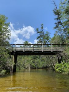
The boardwalk is ideal for walkers and runners with a 1 mile stretch of mostly-shaded pathway and markers located every ¼ mile. All along the way are informational placards providing insight about the local flora and fauna.
What’s the common flora? Towering cedar and cypress trees, a variety of pines, wild magnolia, and a number of different types of ferns and palms. This thick, damp undergrowth provides a perfect environment for an array of birds, including ducks, falcons, herons and egrets, frogs, turtles, snakes and even a few alligators. (Don’t let this stop you if you are planning on working your way down the creek! While an occasional snake or alligator may be spotted, it is fairly wide for a creek and there are plenty of other places for animals than in a swiftly moving waterway.)
As you near the top end of the boardwalk, you’ll see an area dedicated to parents who have lost a child, called “The Path of Memories.” Placards representing these children and their journeys can be read around the pavilion there. It’s a beautiful, serene setting to remember these children’s lives.
Navigating Turkey Creek
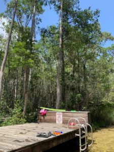
Kayakers and paddle boarders are able to use any of the Niceville swim platforms to enter the creek, but because the mouth of the creek is just on the other side of the highway, right there by the park entrance, many choose to take their equipment up to Crestview and work their way down, making it longer and more interesting. There is also a canoe launch site by the College Road entrance to the trail.
Most people use the Niceville section to float or swim. If you’ve not been before, get ready! It’s chilly!
On any given hot summer day, you’ll see people drop their towels at their chosen exit platform and walk further up the creek to jump in with swim noodles, life jackets, tubes and small rafts for buoyancy while the moving creek waters take them down-stream. Much of the creek is shallow enough to stand up, but some sections are a little deeper; having something to help with buoyancy can make the float a lot more relaxing.
Bringing a snack or a meal to enjoy after drying off is a perfect way to end a float down Turkey Creek.